
Jeremy Garniaux shared these pics from a display in the forecourt of the Gare De Lyon. “A beautiful series of almost MapsInTheWild was waiting for me this morning on the forecourt of the Gare de Lyon this morning, as I arrived.” I wonder how they chose the images for this […]
Maps in the Wild
1938 posts
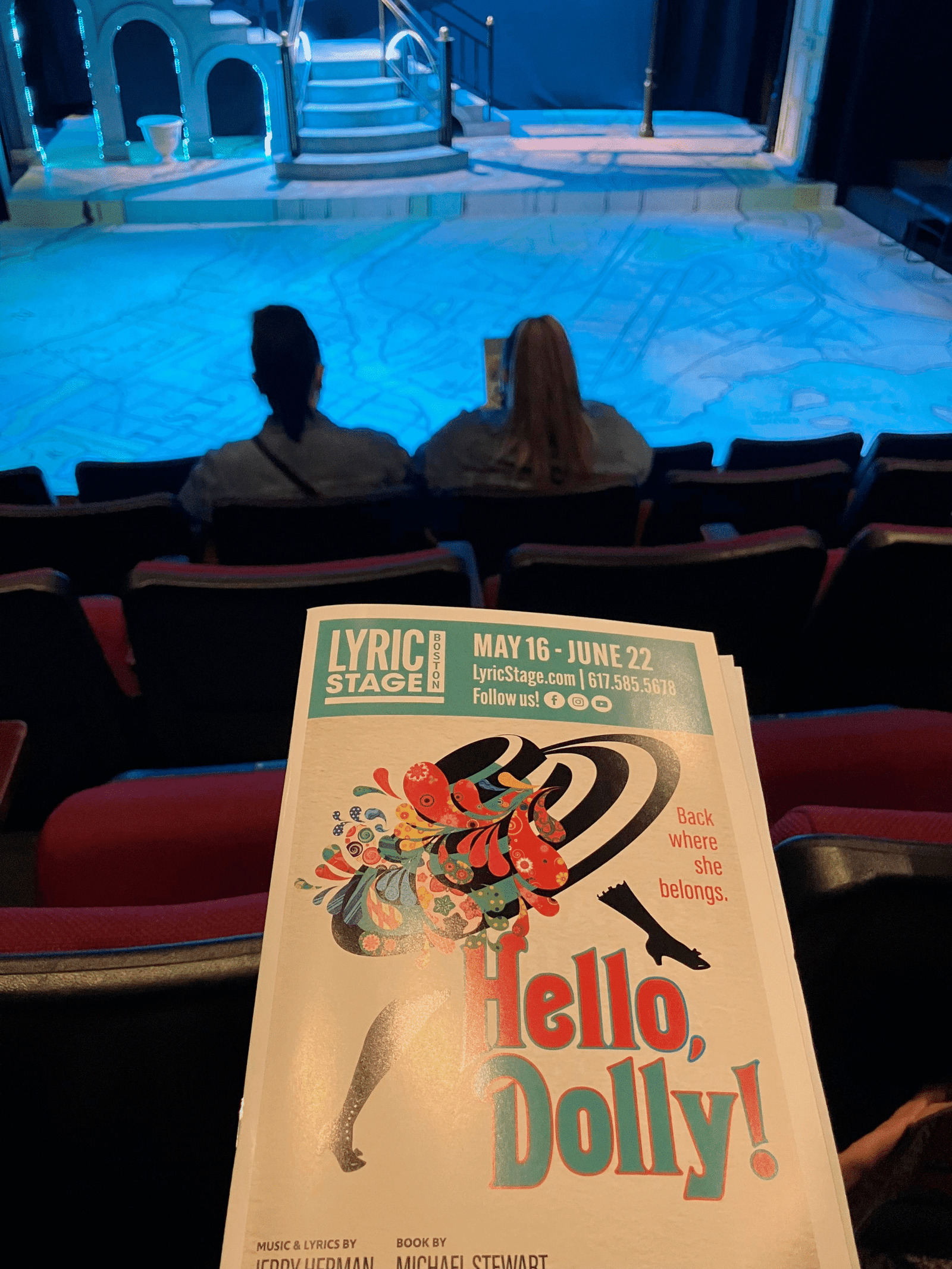
Matthew Edney spotted this map of Yonkers on the floor of the stage at a performance of Hello Dolly. “Map of Manhattan/Yonkers on floor of stage for Lyric Stage production of Hello Dolly (in Boston) … nifty” Nifty indeed!


Chiara Phillips presented at Geomob Berlin with a MapsInTheWild-approved dress code. Tonight is the Geomob London event, will anyone wear maps in the wild?

Doug shared this “Valpolicella Wine Region @ Tenuta Santa Maria di Gaetano Bertani Winery. Beautiful relief map


Reinder spotted this in a thrift shop. It’s a book of Ukrainian poems translated into English. We are wondering if the map is Kiev or …? Maybe one of our Ukrainian followers can help us out? Regardless this is a high impact book cover and could become one of my […]

Angel Arenas sent me this pic of his latest giant interactive map in a square in Valencia. The map is 230 square metres, that’s pretty massive. Maybe the biggest ever?

Reinder sent us this superb map of Amsterdam made out of padlocks. He said ” map of padlocks in the Groenburgwal (canal) in Amsterdam. To commemorate the 750th anniversary of the city. They do this here because many people attach a padlock to the nearby bridge. To kind of ‘seal’ the […]

Marc-Tobias sent me this picture of his new hat. Can you work out when the map was printed and why? According to Ian Turton this xkcd may help you date the map
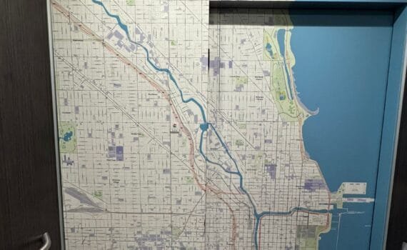
Mark shared this impressive map on the entrance to an elevator (lift in English) at the Chicago Hyatt Place.


