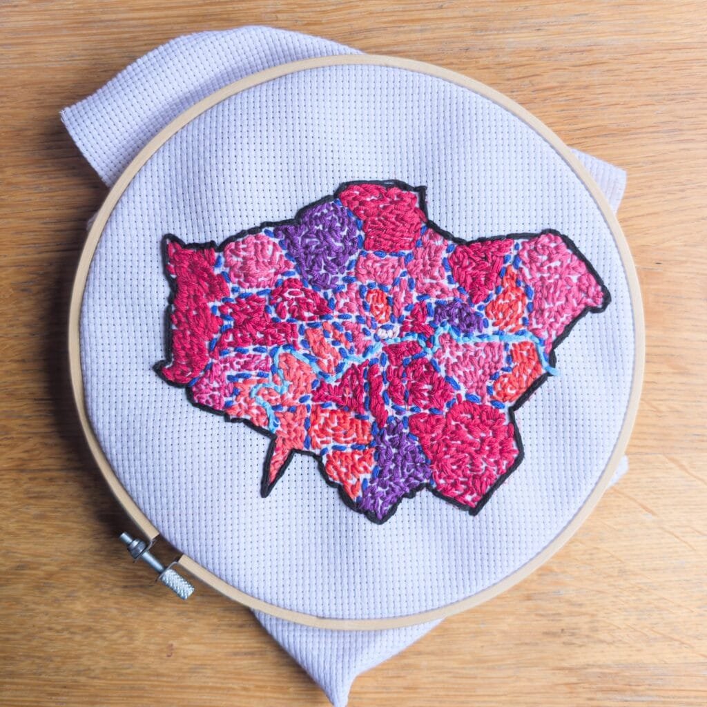
My pal Giuseppe Sollazzo has an incredibly wide range of interests which include geography and embroidery. He recently completed his latest project – “Mission accomplished 🙂 Choropleth of London councils by population, with a terrible palette choice! Data from wikipedia, shapefile from Ordnance Survey”
I asked him what prompted the idea for this embroidered map – “The idea fundamentally came from my recent interest in trying more analogue experiences while not completely giving up my data & digital passions. Which means I’m doing less internet, more ham radio, and less javascript maps and more physical ones. Having recently learned crochet, I thought that embroidery would be great for data visualization. It takes a while so it’s an act of love to data 🙂 But the result is oddly pleasant.”
I think we can all agree that it is more than oddly pleasant! If there was a Nobel Prize for geogeekery, I think Giuseppe would be a winner.


