While we were in Israel we spent some time in Jerusalem, friends suggested that we visit the new museum about Jerusalem in King David’s Tower. It is a fantastic museum in an ancient location which reflects the different influences in the city over three millenia. Amongst the many exhibits were a lot of maps, ancient, modern, interactive, over the next few days I will share a few.
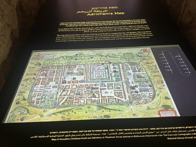
Adrichem was a 16th century Dutch cartographer, this map of Jerusalem shows remarkable detail
“A map of Jerusalem created by the Dutch cartographer Christiaan van Adrichem in 1584. In this beautifully illustrated map are drawings that represent events and figures from the Old and New Testaments. Toward the center of the map the Jewish Temple can be seen together with a drawing of the High Priest, the altar and the vessels used in the Temple. To the right of the Temple is the Royal Palace, pictures of King Solomon on his throne, and even Bathsheva bathing on her rooftop. Other drawings on the map, such as the Via Delarosa and images of the Crucifixion, depict the Christian history of Jerusalem.”
https://web.nli.org.il/sites/nli/english/digitallibrary/pages/viewer.aspx?presentorid=EDU_XML_ENG&docid=EDU_XML_ENG002367978


