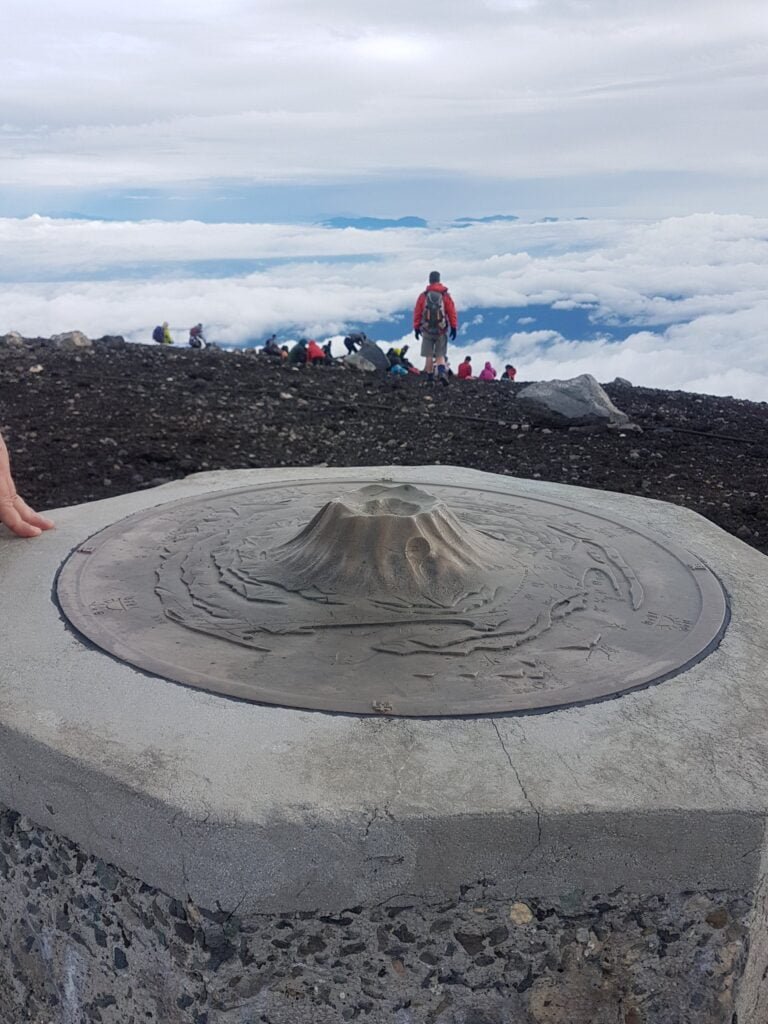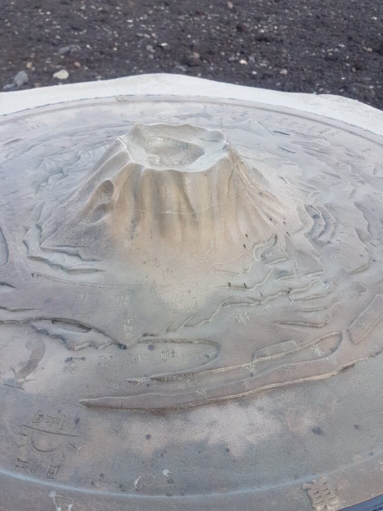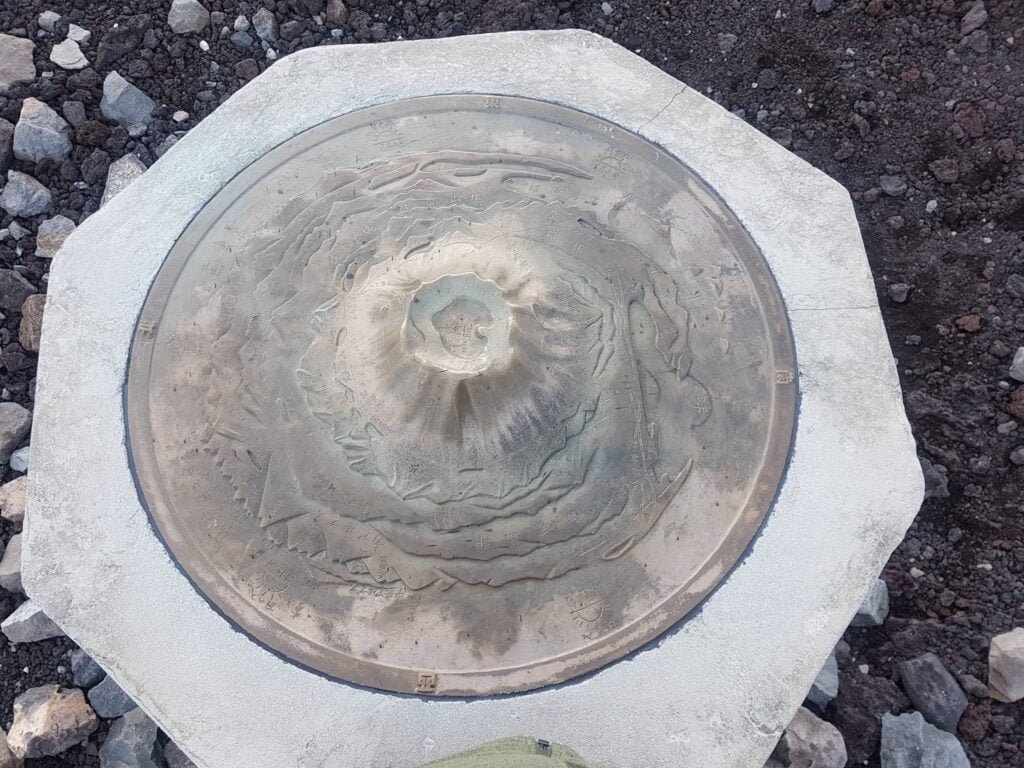
Quite a few of our friends made the journey to Tokyo for ICC2019 (International Cartographic Conference) and of course they were on the lookout for Maps in the Wild. Over the next few weeks we will be sharing some of their finds.
Anton Thomas is a fantastic map maker who spotted this tactile map at the top of Mount Fuji. The conversation about the accuracy of this relief map between him and some other map geeks is worth sharing:
Found this lovely tactile map in an extremely dramatic location – the summit of Mt Fuji. Shows a kind of fisheye perspective, with all sorts of features around it, stretching as far as Tokyo Bay and the Izu Islands. #mapsinthewild #icc2019tokyo
Only complaint is that the centerpiece is shaped nothing like Fuji, which has such a famous beautiful profile… but this is to allow for more detailing and labeling around the crater and rim.
To which Mark Jeffrey of GoodWood Globes replied:
That was my first thought: that can’t be Mount Fuji! What a shame, there seems no reason not to make this geographically accurate. Awesome nonetheless, thanks for sharing

Anton to Ken
It bugs me it’s shaped nothing like the perfect cone of the world-famous mountain it represents… but to allow detail and labeling around the crater rim it is understandable. To get that crater detail AND have the right Fuji shape would require a map 4x bigger.
Ken
Only someone with a keen eye for cartography would climb Mt Fuji and complain at the quality of the map atop 😉 I’d likely have been apoplectic.

Anton summing up
I think I was quite forgiving about this major flaw in the map because the katakana/kanji labels look so damn pretty… along with the profoundly epic location and fatigue/sleep deprivation.
The more I think on it.. brazenly mangling the centrepiece, which happened to be one of the most iconic mountains on Earth, famous for its distinct shape… with your map having the honour of being located somewhere as hallowed as the SUMMIT of said mountain… is a disgrace!


