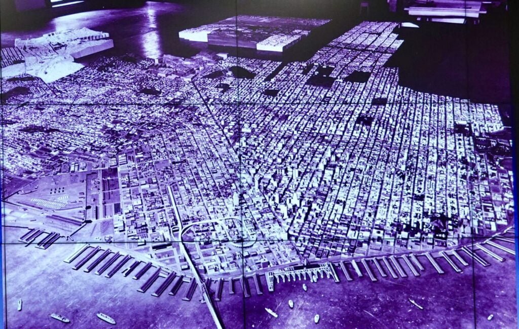
Walter Schwartz sent us these pics of the San Francisco City Model, the first one is how it appeared in 1939
“While I’m on a roll, here are edited photos taken during a California Map Society presentation in August. The San Francisco City Model is a modular 3D map of San Francisco that was a depression-era WPA (Works Progress Administration) project completed in 1939. It mostly collected dust from the 1940’s until 2018, when it was restored.
In restoration. It was intended to show every building and topography in 3D.

The clever design leveraged the city’s grid system. Neighborhoods with streets were constructed independently an then joined. Blocks were constructed independently of the neighborhoods and dropped in between the streets.

Today, neighborhood libraries exhibit many of the neighborhood sections. The restoration group says that the models engage citizens’ interest in their neighborhood’s role in the city, kids love it, and everyone looks for their house (if it was built pre-1940).


