Ben Hennig sent us this from Reykajvik
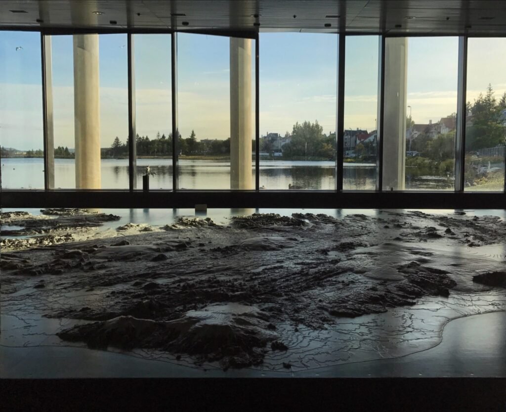
“I love your ‘Maps in the Wild’, so I thought of adding a contribution to it from my little rock in the middle of the Atlantic. Though not fully ‘in the wild’, I think this is a pretty nice map to see when being out and about, even if it technically is inside. Attached you see a photo of the map of Iceland showing the country in 1:50,000 scale turned into a 3D map made from some sophisticated cardboard layers (with a 1:25,000 scale for elevation). The model was created based on post-war mappings made by the Americans. It can be seen in Reykjavik City Hall (free and open to the public, https://visitreykjavik.is/reykjavik-city-hall) most of the year (apart from when they use the venue for events) next to the city pond (Tjörnin) which incidentally gives a sense of scale since when using the same scale as the map, the pond outside the window is about the same-scale size of Greenland, giving a real impression of how these two neighbouring countries compare.
Maybe that is good enough for you to include in your Maps in the Wild collection!
All the best from the North,
Ben”


