
On Easter Monday, my wife suggested that we go to the Spain and the Hispanic World exhibition at the Royal Academy. There are a couple of maps, she teased to get me interested. Well there were more than a couple of maps!
This is another longish post with a load of pics, you can debate whether they are really “in the wild” but you know the rules (the editor is always correct).
The intro to the maps gallery said:
“Maps were produced to help demarcate territories, nationally, regionally and locally, not only to settle international disputes but also to gather information on these new lands and the people that inhabited them. Surveys, like the Relaciones geográficas that took place in Mexico in the 1570s and 1580s, gathered important information about history, genealogy and ownership, often with a view to setting tax levies or appropriating territory.
America, as a geographic term, emerged in 1507, named after the Italian navigator Amerigo Vespucci, whose nephew drew the important and incomplete world map seen here. Western parts of the continent remain uncharted as information on what lay beyond certain unexplored points was lacking. Administrative paraphernalia, like the portable writing boxes, were not only status symbols and thus highly prized for their ornate decoration but were used by bureaucrats carrying out regional visits to gather information and ensure colonial rules were adhered to.“
So now for the maps, first up this beautiful map of the Mediterranean, Black Sea and East Atlantic on parchment by Bartolemo Olives (1552)
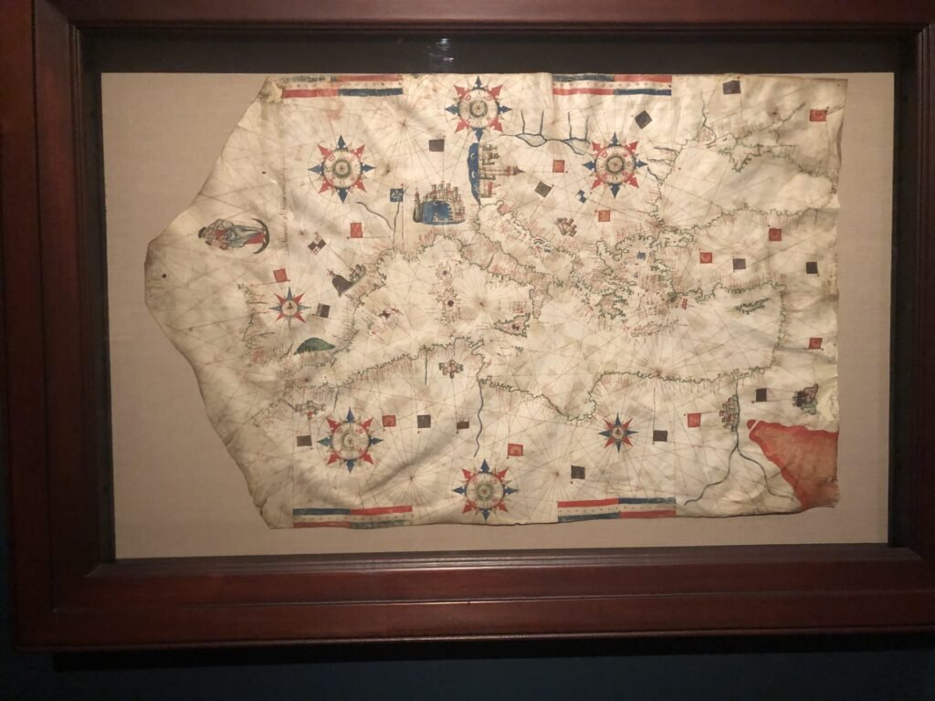
The detail on this atlas of the Mediterranean and Atlantic by Joan Martines (1582) is incredible.
Renaissance nautical charts and atlases, largely centred on the Mediterranean, continued the medieval tradition of portolan charts using compass roses and criss-crossing rhumb lines for navigation. This atlas by Joan Martines comprises five charts, encompassing the Mediterranean and the eastern Atlantic from Iceland to the Cape of Good Hope.
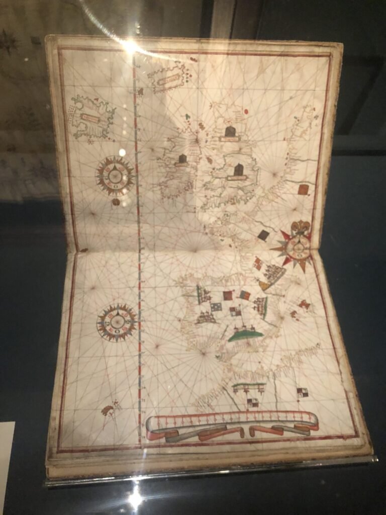
Look at the amazing detail of the British Isles
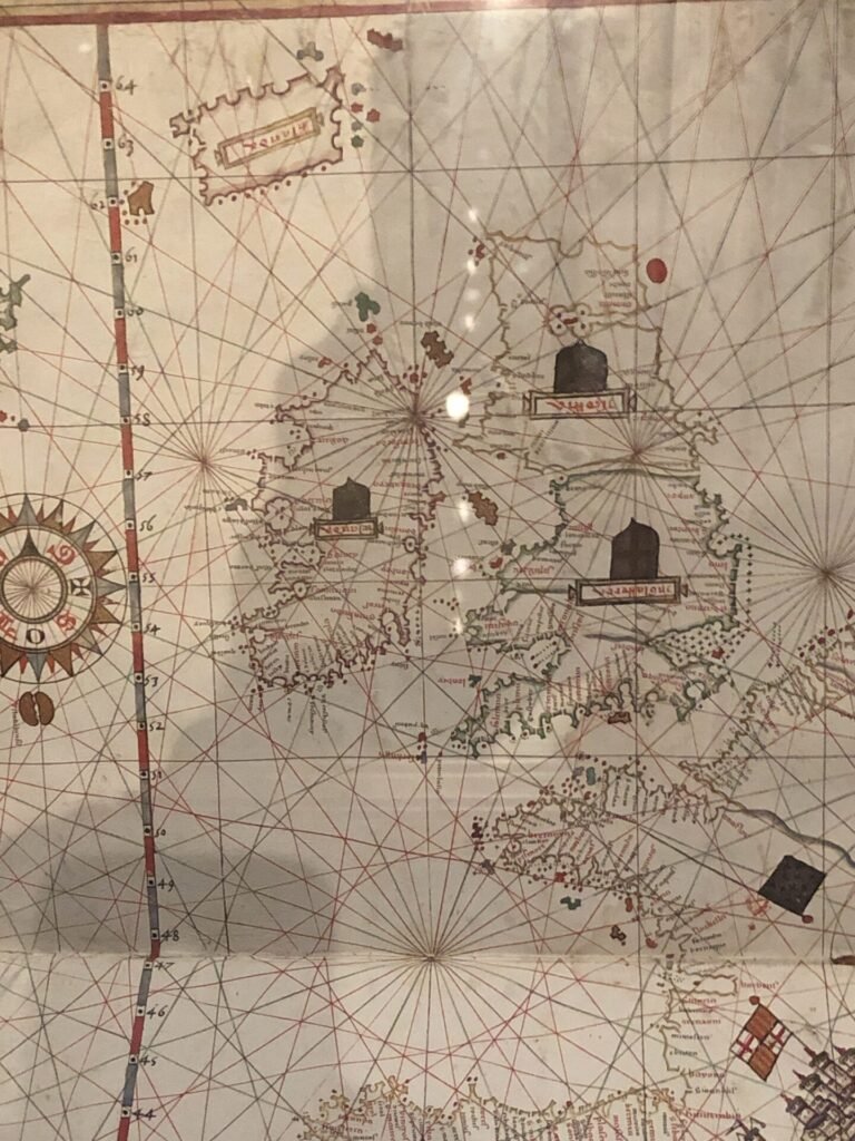
Joan Martines (active 1556-1591) – Atlas of the Mediterranean Sea and Eastern Atlantic, 1582
Illuminated manuscript charts on parchment
Renaissance nautical charts and atlases, largely centred on the Mediterranean, continued the medieval tradition of portolan charts using compass roses and criss-crossing rhumb lines for navigation. This atlas by Joan Martines comprises five charts, encompassing the Mediterranean and the eastern Atlantic from Iceland to the Cape of Good Hope.
Here are some images from the Vespucci world map, the western side of Latin America is still an unknown while Europe and Africa are pretty well mapped.


Giovanni Vespucci, (Florence, Italy 1486-after 1527) – World Map,1526
Ink and colour on four sheets of parchment
Copies of the Padrón Real, the master nautical chart, were distributed to navigators by the Casa de Contratación (House of Trade) in Seville, the body responsible for overseeing all exploration, colonisation and commerce between Spain and its rapidly expanding empire in the Americas. This ornate copy was probably intended as a gift for Charles V on his marriage to Isabella of Portugal.
The maps of from the early period of the colonisation of Mexico are fascinating, this one is of Tequaltiche
Map of Tequaltiche, 1584 – Watercolour and ink on paper
Produced as part of the Relaciones geográficas, an extensive survey of the land and people of Nueva España ordered by Philip II, this map of Tequaltiche originally illustrated an accompanying questionnaire. Embedded in the map is significant historical and geographical information about the Caxcan people of Tequaltiche, an indigenous village in what is now the western state of Jalisco.
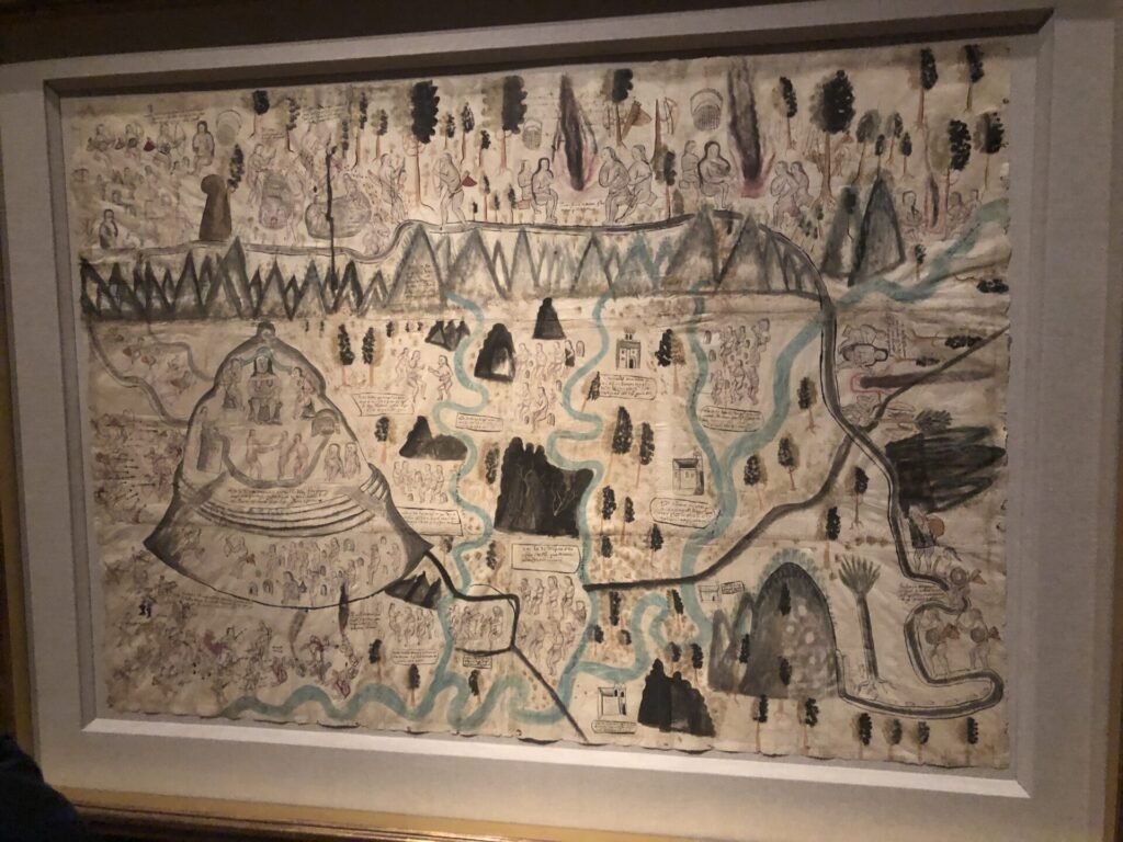
This is a lovely strip map of the Ucayali River
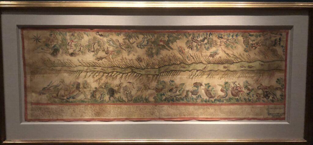
Map of the Ucayali River, 1808-12
Pen and brown ink and watercolour on paper
A main tributary of the Amazon, the Ucavall River rises north of Lake Titicaca in the Arequipa region of Para. This important map was prepared by Franciscan missionaries with the assistance of indigenous artists, graphically illustrating the fauna and peoples – And (Ashaninka), Cashiba Chontaquro, Conibe pitinet, Panoba, Shetiba and Shipibo of the region, as well as Franciscan missions and Ucayali tributaries.
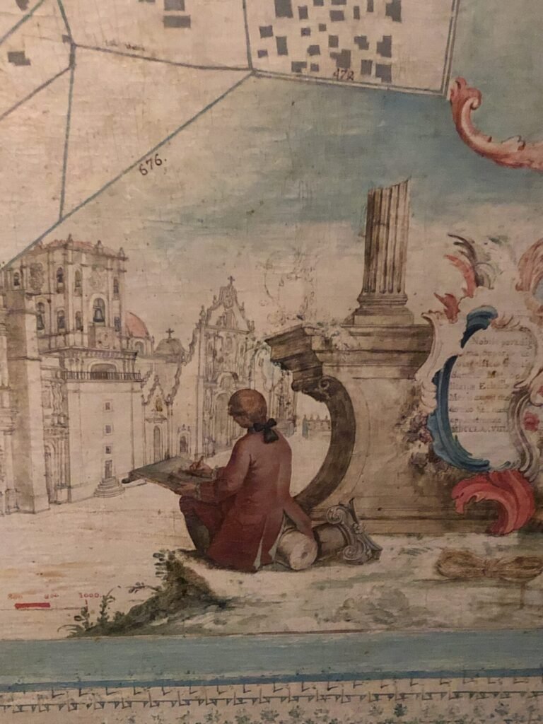
And finally this plan of Mexico City (1778) by Ignacio Casterra

And a little more exquisite detail
If you happen to be in New York, I would highly recommend that you find an hour or two to visit the Hispanic Society Museum & Library to have a look at their maps collection.


