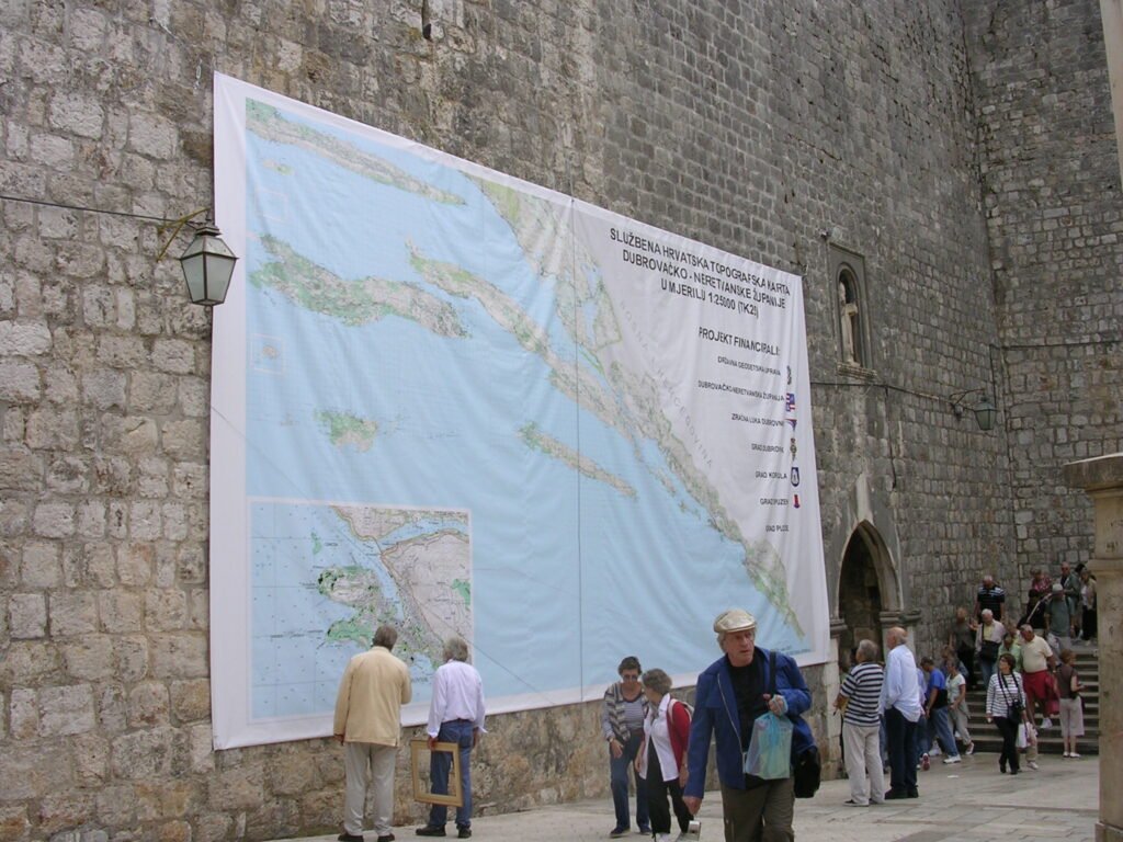
Dave Lovell sent us this pic of the world’s largest map being unveiled in Dubrovnik in October 2007.
This map of Dubrovnik-Neretva County is is 11m wide and 6m high, it is made up from 40 1:25k sheets enlarged to a scale of 1:15k. Is that the largest in the world? I am not sure, the America Latina map is pretty massive and might be its equal (although it is pained not printed). The Guinness Book of Records awarded the map a certificate as the world’s largest printed map.
You can read more about this mega map in the paper by Ivan Landek, Igor Vilus and Ivan Grubić of the State Geodetic Administration, Croatia


3 thoughts on “The world’s largest map”
The Great Map of Scotland in Barony Castle may be the biggest relief map in the world. 40m x 50m.
I can see this “biggest map” thing running on and on. Any offers over 40m by 50m?
Undoubtedly, the biggest map ever printed (not done as a single piece for someone) is Soviet “Gusudarstvennaya karta SSSR” 1: 100 000 printed in 1940’s. 182 sheets forming one gigantic 50 square meters list.