
We have seen a lot of maps as art since we started Mappery, but when Arnaud showed me these maps by Ed Fairburn I was blown away.
I reached out to Ed who gave me some great images and a little explanation of the images.
“‘Edgware’ (above) utilises the road layout of the map, with the aim of preserving the shape of the network of roads and streets, by working in the spaces between. The idea is to compliment the general composition created by the network”
BTW, I lived in Edgware as a kid nav the north west corner of the map.
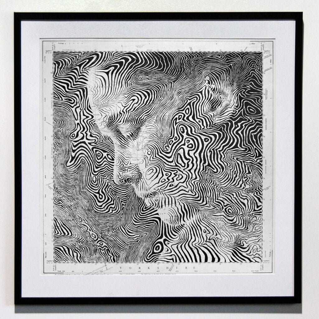
‘Fountains Earth’ is a prime example of the technique which I’ve coined as ‘topopointillism’ – a direct combination of topography, and pointillism. Like any kind of pointillism, the perception of the subject will change depending on how closely the work is viewed. At close range, the viewer is unlikely to see the portrait, but will see the map details – when viewed from a distance, it’s the other way around. Lines of elevation are used as the pattern base, or vehicle for the subject. Line widths and proximity to one another are altered to create a tonal range.

‘Denver Southbound’ broadly combines the above two techniques – it uses lines of elevation, but also the very small spaces between the streets of Denver, as an area for crosshatching.
This is some of the most amazing map art that I have seen and I am certainly going to be buying something from Ed. His online shop is here.

